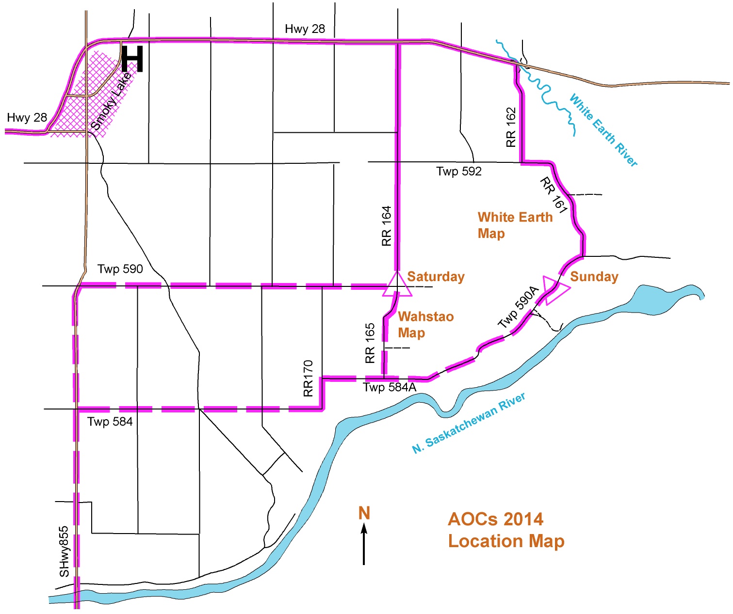
Wahstao / White Earth Location map
Allow approximately 1 hour 45 minutes from Edmonton to get to either map. Directions below
From east Edmonton (and Calgary): (You should consult a provincial road map if using this route).
Take the Yellowhead east, then Hwy 21 north and then Hwy 15 northeast past Fort Saskatchewan.
Turn north/left onto SH 830 (sign posted ‘Vinca Bridge’)
At the T-junction turn east/right onto Hwy 38, which soon becomes Hwy 45, still going east.
After driving for a total of about 34km due east, turn north on SH 855 towards Smoky Lake.
SATURDAY:
About 8km after crossing the North Saskatchewan, turn right/east along Twp Road 590. At the T junction, look for other parked cars.
SUNDAY:
About 4.3km after crossing the North Saskatchewan, turn east/right along Twp 584; this road bends north after about 6.5km and becomes RR 170.
After going north less than a kilometre, turn east/right onto Twp 584A.
Follow this road (and the orienteering signs!) for about 7km, as it heads northeast and changes to Twp 590A. Watch for a wide gas pipeline clearing and other parked cars.
From north Edmonton: 97 Street then Hwy 28 to Smoky Lake.
SATURDAY: continue east on Hwy 28 for almost 7km.
Turn right/south onto RR164. Watch for parked cars after about 6.5km
SUNDAY: Continue east on Hwy 28 for about 10 km after the end of the town.
Turn south/right onto RR 162; this turn is about 50m before the highway crosses the White Earth River.
Drive south down paved RR 162 for about 2.7 km to the T junction. Turn east/left onto Township Road 592.
After about 800m it turns south and becomes RR 161. About 2.5km south down this road you will come to a triangle junction. Turn right and drive for a few hundred metres until you see other parked cars..