Locations – all
- Argyll Velodrome Park 6950 88 Street, off Argyll Road at 86 Street. Location map
- Blackfoot Recreation Area, Waskehegan Trailhead. 20 minutes east of Sherwood Park. Location map
- Capilano Park on the south bank of the river, left at the end of 50th Street. Location map
- Dawson Park – from Rowland Road, turn NORTH onto 89 Street. Follow road to parking lot. Location map
- Coronation Park – entrance from the junction of 139 Street an 114 Avenue Location map
- Gold Bar Park. Access to the park is off 50th Street at equivalent to 110 Avenue, south side of the river. Location map
- Goldstick Park, north off 101 Avenue at 44 Street. Location map
- Hawrelak Park,
main shelter next to the lake, close to the main parking lot. Access to the park is west off Groat Road, south of the Groat Bridge. Location map
- Hawrelak Park,
Picnic Shelter #2, two-thirds of the way round the one-way park road. Location map
- Hermitage Park Access off Victoria Trail, just north of the Yellowhead Hwy, onto Hermitage Road. Location map
- INIW / River Lot 11 Park – access to the left off Queen Elizabeth Park Road, (which is one way north bound), where the old Queen E pool used to be. 40 parking spots. Location map
- Kingswood, St Albert
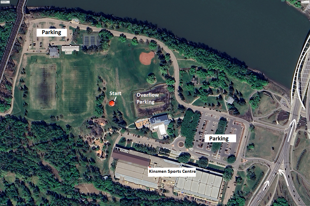
- Kinsmen Park, bottom of Walterdale Hill and Queen Elizabeth Park Road, both one-way northbound. Location map
- Kinsmen Park, bottom of Walterdale Hill and Queen Elizabeth Park Road, both one-way northbound. Location map 2
- Laurier Park, south end of Buena Vista Road, near the zoo. Location 7 Location 8
- Mill Creek – upper Mill Creek pool parking lot on 95A Street, north off Whyte Ave.
- east side of Mill Creek Ravine at Ecole Maurice Lavallee, 88 Avenue/95 Street. Location map
- Nellie McClung Park starting at the south end of the parking lot of the Old Timers Cabin (9430 Scona Road).
- Strathcona Science Park off 17 Street NW, south of the Yellowhead, or north of 101 Avenue. Once in the park, turn right to the ski chalet parking lot. Location map
- Terra Losa Park southeast part, at the intersection of 176 Street and 95 Avenue Location map
- Terwillegar Park, Terwillegar Park, at the west end of Rabbit Hill Road, off Terwillegar Drive. Please note: this park is an off-leash dog area, and also popular with mountain bicyclists. Location map
- Whitemud North, access north off Fox Drive onto Keillor Road. Location map
- Whitemud South Park Access is west off 119/122 Street, just south of the Whitemud Freeway. Location map
- Red Willow Park, St Albert. Behind St Albert Centre shopping mall, 375 St Albert Trail, next to the river and close to the Benoit footbridge. Location map
- Rundle Park, access south off 118 Ave at Abbottsfield Road, or 113 Ave near 30 Street. Location map
- Cloverdale Shelter in Henrietta Muir Edwards Park NO LONGER AVAILABLE at 96A st / 98A Ave, north of the Muttart Conservatory. Location map
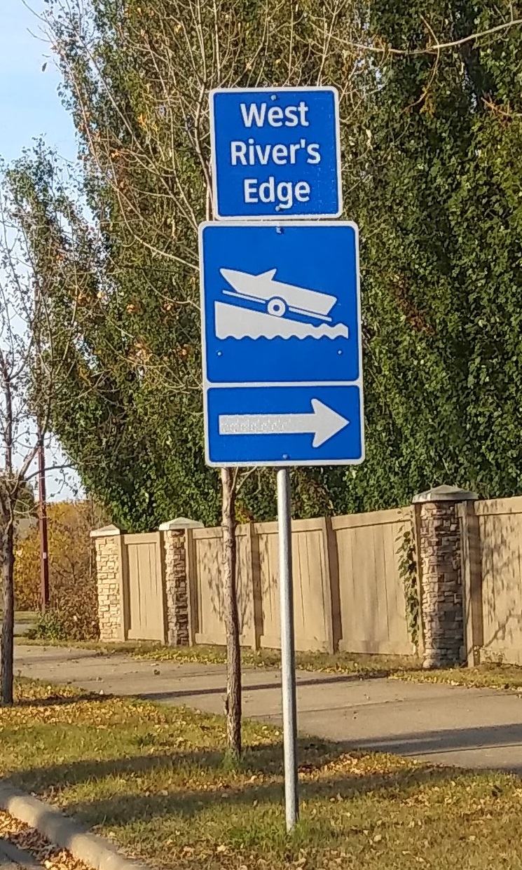
- West Rivers Edge Park Pavilion, 1875 River Valley Drive, Fort Saskatchewan. West River’s Edge Park is near the south end of Fort Saskatchewan. From Hwy-21, turn west onto Westpark Blvd, then follow the signs to West River’s Edge and the Boat Launch symbol. The pavilion will be on your left just before you get to the boat launch. Location