Saturday, June 10, 2017
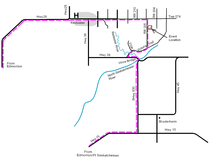
2017 TRAVEL ADVISORY: lots of road works on Hwy 28. A better route choice could be via Fort Saskatchewan on Hwy 15, SH 830, Vinca Bridge and Victoria Trail (see map below)
On the Dalmuir map, 13km east of Redwater, in the Redwater Natural Area.
Register and Start from 10:30 pm – 1pm, and finish no later than 3pm.
Format: five loops to choose from including
– a beginner/novice loop on or near trails (with some sections of following ribbons). Suitable for beginners and families. Beginners clinic and/or extra coaching available.
– an intermediate loop suitable for those with some experience such as Wednesday evening medium and long courses. Extra coaching available.
– several advanced loops of varying lengths.
NB: no extra charge for doing more than one loop (as long as you have time before course closing).
Fees: $10 per member individual/couple/family. Fee includes a map, rental of SPORTident timing card, rental of compass and whistle if you don’t have your own.
$15 per non-member individual/couple/family. Fee includes a map, rental of SPORTident timing card, rental of compass and whistle if you don’t have your own.
$5 per additional map for couples/families going out together.
Driver’s license required as deposit for rentals.
What to bring: clothes suitable for the weather, sunscreen, your own water supply if it’s VERY hot. Compass and whistle if you have them.
Directions:
Take Hwy 28 north to the Redwater turn-off. After the realignment bend, drive straight i.e. due EAST, for approx 13km. The road changes from paved to gravel, and the road number changes TWICE! Just drive straight. At RR 205, turn right/south and follow the orienteering signs. registration will be on the left/east side of RR205.
The event site can also be reached from highway 38 west of the Vinca bridge on Victoria Trail turning north at range road 205 for 2.7 kilometers.
GPS coordinates are N53.92793 W112.95088
Organizer: Wayne Best, Orienteering Canada level 200 official (in training).
Location Map: Google maps link here
2017 TRAVEL ADVISORY: lots of road works on Hwy 28. A better route choice could be via Fort Saskatchewan on Hwy 15, SH 830, Vinca Bridge and Victoria Trail (see below)