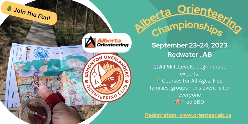
2023 Alberta Orienteering Championships
September 23rd and 24th
On-the-day on-site registration available for- beginner, novice and intermediate recreational courses.
UPDATES: 15th Sept: Course planner’s notes added. 10th Sept: course lengths finalized, Sunday location lat. and long. changed.
Don’t feel daunted by the name – this will be a lively event suitable for everyone, including kids, families and groups. Plus, on Saturday, there will be a free BBQ to enjoy(while supplies last). Join us for some great orienteering fun!
This may be a Canada Cup event (sanctioning has been applied for) with Middle distance and Long distance races, but no Sprint.
Registration now closed for competitive age-based categories and OPEN advanced courses
On-the-day, on-site registration for Beginner, Novice and intermediate recreational courses available for individuals, pairs and groups. Times and locations listed below.
There will be SPORTident timing.
Which Course/category to choose
MIDDLE DISTANCE – Saturday September 23
Map: Dalmuir East
1:7,500 scale; 2.5 m contours
12:30 check-in
13:00 – 14:00 starts
Time limit 2 hours (but no later than 16:30)
16:30 Awards on-site
There will be water available at the start and finish, but none on the middle courses.
LONG DISTANCE- Sunday September 24
Map: Dalmuir East map
1:10,000 scale, 2.5 m contours,
10:30 check-in
11:00 – 12:00 starts
Time limit 3 hours (but no later than 15:30)
15:30 Awards on-site
There will be water available at the start and finish and on the long courses.
FEES:
Registration Closed: Age-based Championships and open categories:
Recreational courses (beginner, novice and intermediate): $10 per individual/pair/family, each event, including groups (one map) Additional fee for second map for groups.
SPORTident timing card, compass & whistle is available to borrow if you don’t have your own
Organizers:
Event Director: Mary-Lou Hogg (O300 official)
Course planner: Kim Kasperski (O200 official)
Controller – Middle Event: Robert Gilchrist (O300 official)
Controller – Middle Event: Angela Pearson (O200 official)
Controller – Long Event: Greg Yarkie (O300 official)
LOCATION AND DRIVING DISTANCES:
Directions for Saturday Event:
(Sunday’s directions are below.)
The location of the Saturday event is shown here: https://www.orienteer.ab.ca/locations/dalmuir4location/
GPS coordinates: W112.926626 N 53.939365
Northern Route: Take Hwy 28 north to the Redwater turn-off. After the realignment bend, (passing Tim Horton’s, the Hospital, RCMP detachment) drive straight i.e. due EAST, for approximately 13km. The road changes from paved to gravel, and the road number changes TWICE! Just drive straight. At RR 204, turn right/south. Start/finish location [unmarked] will be about 800m on the right by the sandy earth bank.
This section of RR204 does not appear on Google maps. NB the east side of the road is private property.
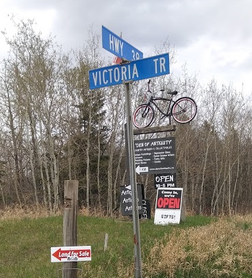
Or via Fort Saskatchewan, then northeast on Hwy 15, north on SH 830, west on Hwy 38, crossing the Vinca Bridge. Then turn north onto Victoria Trail at the Den of Antiquity sign. After 3- 4km, turn left/north at RR 205. Go to the end of the road and turn EAST onto TWP 574, then SOUTH onto RR 204. Start/finish is about 800m down the road on the right, next to a sandy bank.
This section of RR204 does not appear on Google maps. NB the east side of the road is private property.
Or via the Ugly Industrial route, Manning Drive, north on SH 825, east on SH 643, then east (right) on Hwy 38 . Then turn north onto Victoria Trail at the Den of Antiquity sign. After about 3-4km, turn left/north at RR 205.
Go to the end of the road and turn EAST onto TWP 574, then SOUTH onto RR 204. Start/finish is about 800m down the road on the right, next to a sandy bank.
This section of RR204 does not appear on Google maps. NB the east side of the road is private property.
Location map here: www.orienteer.ab.ca/locations/dalmuir4location/
Directions for Sunday Event
The location of the Sunday event is shown here: https://www.orienteer.ab.ca/locations/dalmuir5location/
GPS coordinates: W 112.9509 N 53.92516
Northern Route: Take Hwy 28 north to the Redwater turn-off. After the realignment bend, (passing Tim Horton’s, the Hospital, RCMP detachment) drive straight i.e. due EAST, for approximately 12 km. The road changes from paved to gravel, and the road number changes TWICE! Just drive straight. At RR 205, turn right/south. Start/finish location will be about 2.3 km on the left.. Please park on the east side of RR 205.
Or via Fort Saskatchewan, then northeast on Hwy 15, north on SH 830, west on Hwy 38, crossing the Vinca Bridge. Then turn north onto Victoria Trail at the Den of Antiquity sign. After 3- 4km, turn left/north at RR 205. Drive north until you see the EOOC club banner. If you reach TWP 574, you have gone too far north.
Or via the Ugly Industrial route, Manning Drive, north on SH 825, east on SH 643, then east (right) on Hwy 38 . Then turn north onto Victoria Trail at the Den of Antiquity sign. After about 3-4km, turn left/north at RR 205.
Drive north until you see the EOOC club banner. If you reach TWP 574, you have gone too far north.
ACCOMMODATION:
Hotels near Redwater/Edmonton
Campsites near Redwater