Sunday October 26
Register here – registration form is open until Saturday October 25 at 1pm
Please register to guarantee yourself a map! We will try to print extra but RSVP helps us know how many copies to print.
Sprints @ Government House (12845 102 Ave NW)
| Date | Sunday October 26 |
| Map: | Government House (brand new map!) 1:4,000 scale 5m contours ISSprOM 2019-2 (Sprint symbols) |
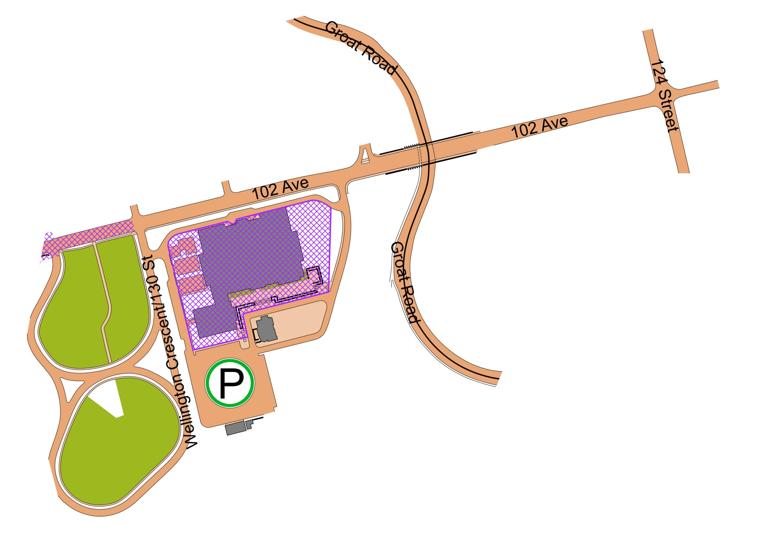
| Location: | 12845 102 Ave NW The Wellington bridge is under construction, so the easiest access is from the east. From 124 Street, go west on 102 Ave. Go past the old museum then turn left at Wellington crescent (130 St). Take an immediate left to enter the parking lot. |
| Cost: | $5/map OR bring a non-perishable donation for the Food Bank |
| Courses: | Choice of 3 courses: Short – 2.2 km Medium – 2.5 km Longer – 3.1 km |
| Timing: | SportIdent in Air mode We will have SI Air finger sticks available to lend if you don’t own one. |
| Start window: | from 1:00 to 2:00pm Check back in no later than 3:00pm |
| Mapper and event organizer: | Stefan D |
Notes:
The map has been drawn using the sprint symbol set ISSprOM 2019-2. Of particular note I used the symbol 533 “Area with obstacles” which some people might not have encountered before. Check-out the O-map Wiki for its definition and some examples: https://omapwiki.orienteering.sport/symbols/533-area-with-obstacles/
Otherwise:
- the T symbol (Small tower) represents bat boxes
- X are mostly picnic tables
- O are mostly benches
- Large green X is a pile of fallen trees, or a really unique tree
Because of the bridge construction 102 Ave is really quiet. The courses go through a residential neighbourhood so please be respectful of the local residents.
Because these are sprints and some of you are very fast, you’re welcome to do more than one course