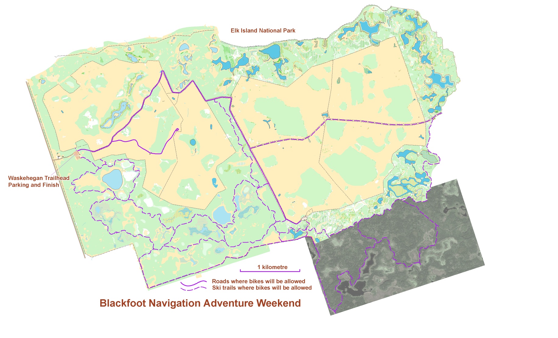
This event is mostly on bike with some controls adjacent to bike trails and some controls 50 to 100 metres from the trail. The challenge will be to plan an efficient route to get as many points as you can within the time limit. Can you get to them all? If not, which will you leave out? My friend Tom tried out a preliminary version of the course and got to all of the points in about 4 hours. If you want to see his route and some photos he took while doing it follow this link Tom’s Route. (Click for Schedule, Fees etc.)
To get enough bike trails for the event we have included a section with just a Google Earth image and another section only partially mapped where we did not have contour information. In total we will be using 45 km of bikeable trails as shown below. The trails are double-track cross-country ski trails that are 2 to 5m wide. The trail surface is hard-packed dirt and grass with some low spots throughout, which are soft and wet.
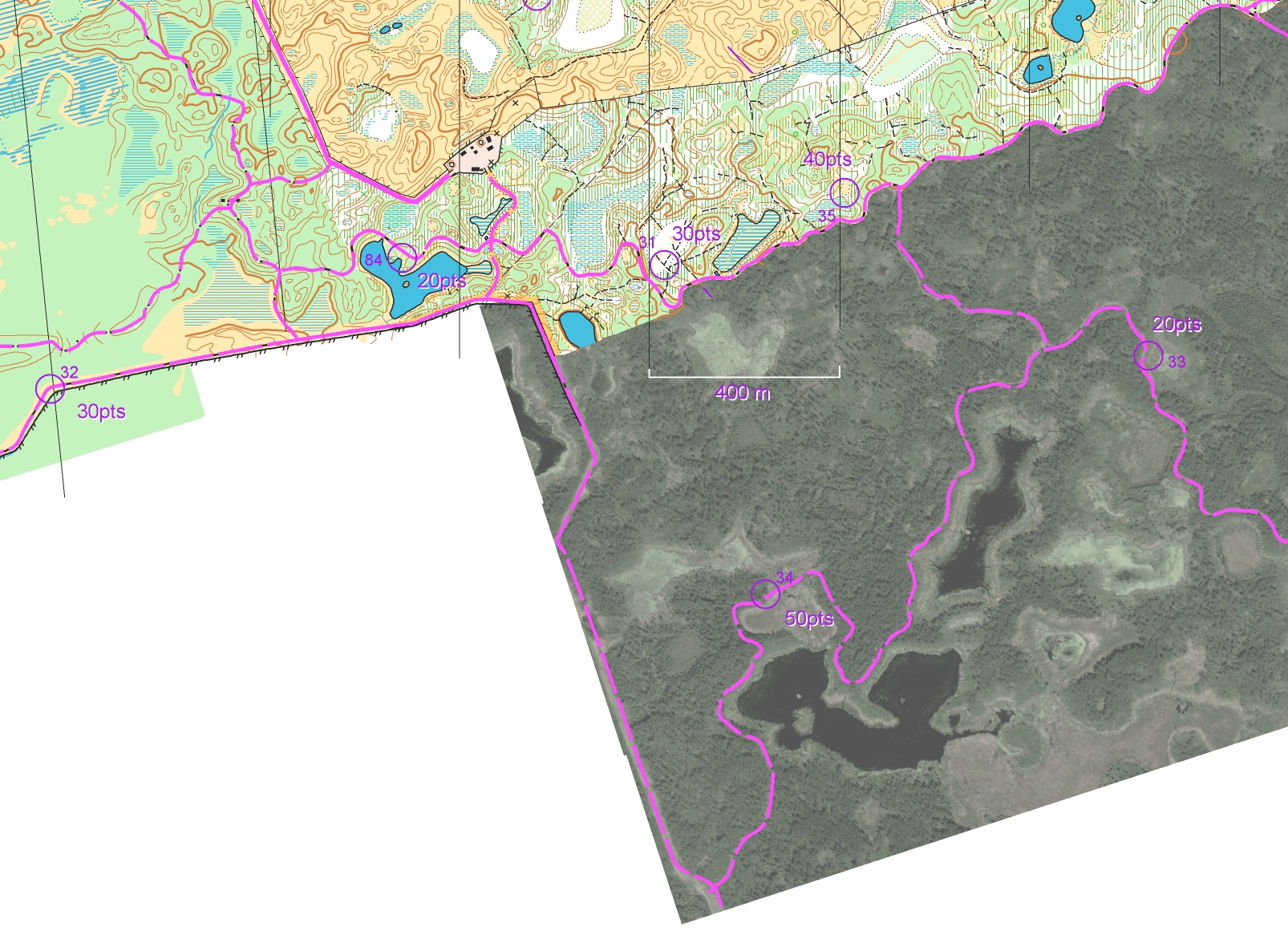
The map below gives an example of how controls might be arranged.
- two 20 point controls within metres of the bike trail.
- one 30 point control that could be collected with about 130 metres on foot.
- one 40 point control that could be reached going 40 metres along a trail and 100 metres through a relatively open marsh or by going 20 metres through thicker bush and only 40 metres along the edge of the marsh.
- the 50 point control has the higher point count even though it is adjacent to the trail because there is a longer ride to get to it.
- the other 30 point control may need a 650m each way detour to get to it.