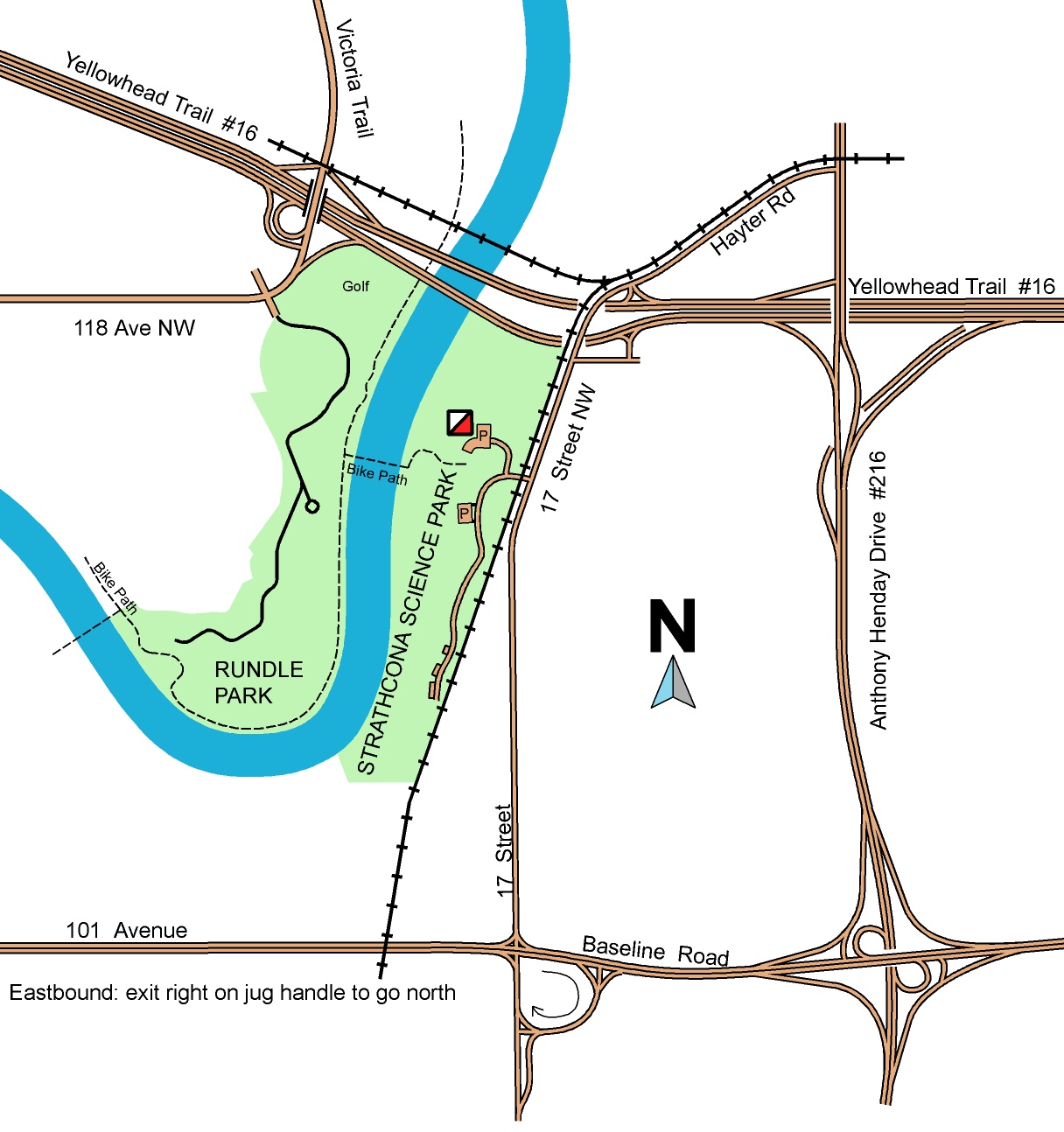
Strathcona Science Park Location Map
Eastbound on the Yellowhead Highway: Follow the signs for 17 Street NW southbound – it’s the first exit from the right hand lane after you have crossed the Beverly Bridge, followed by a couple of right turns (onto 114 Avenue and 11th Street) and a couple of left turns (onto 116 Avenue and 17 Street). These turns are not shown on the map below, but are well sign-posted.
Eastbound on 101 Avenue, exit from the RIGHT hand lane just after the intersection and loop round to join 17th St northbound. Go north on 17th Street for about 2.5km. Park entrance is on your left.
You can also join 17th Street from the Sherwood Park Freeway (exit from the right hand lane eastbound). Registration on June 28, 2023 will be in the NORTH parking lot by the ski chalet (turn right after entering the gate).
NO ETS service to this park. Bicycles/pedestrians via Rundle Park.
Click on the map to enlarge.