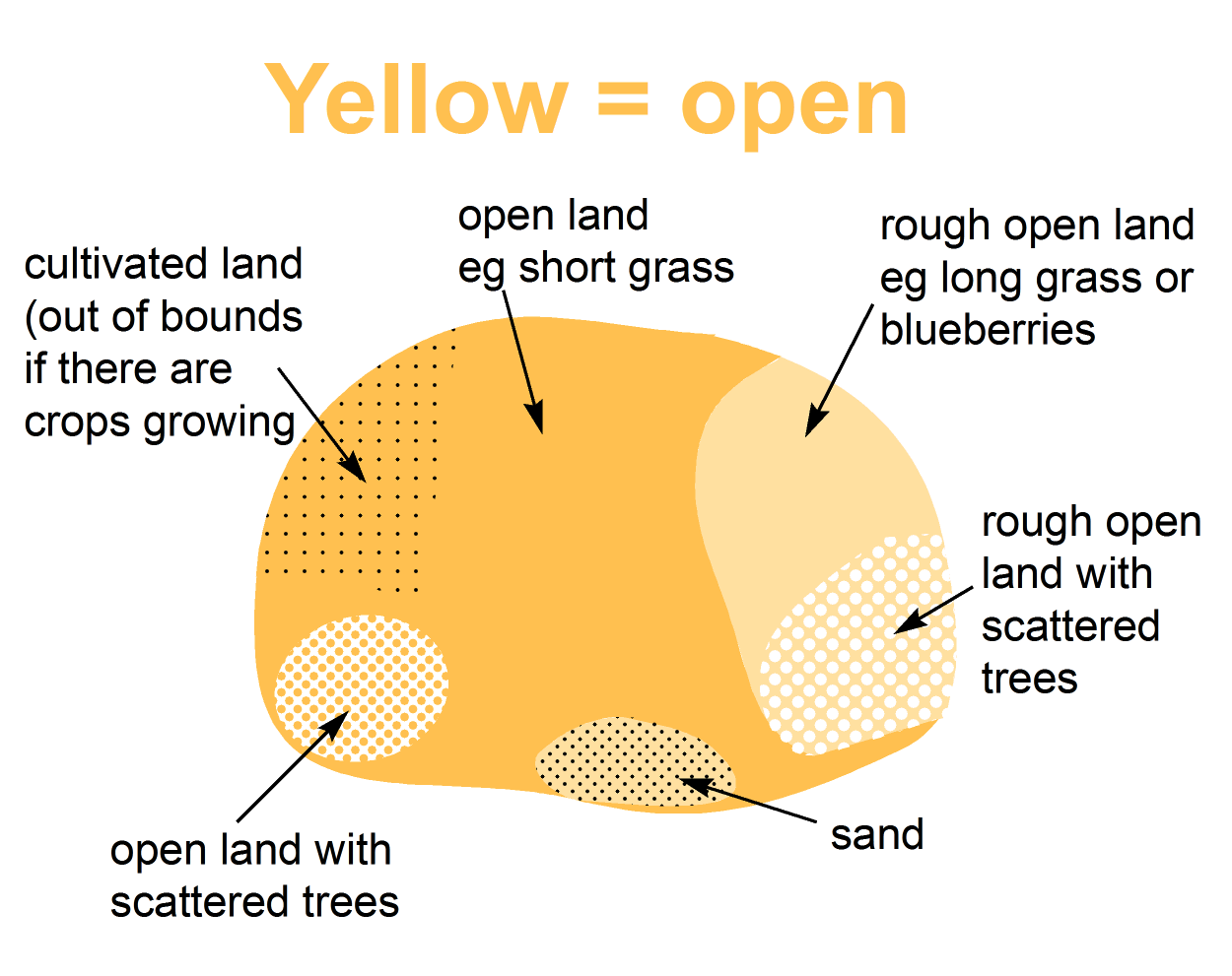
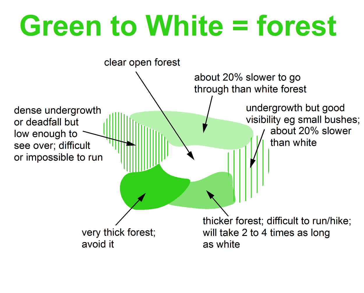
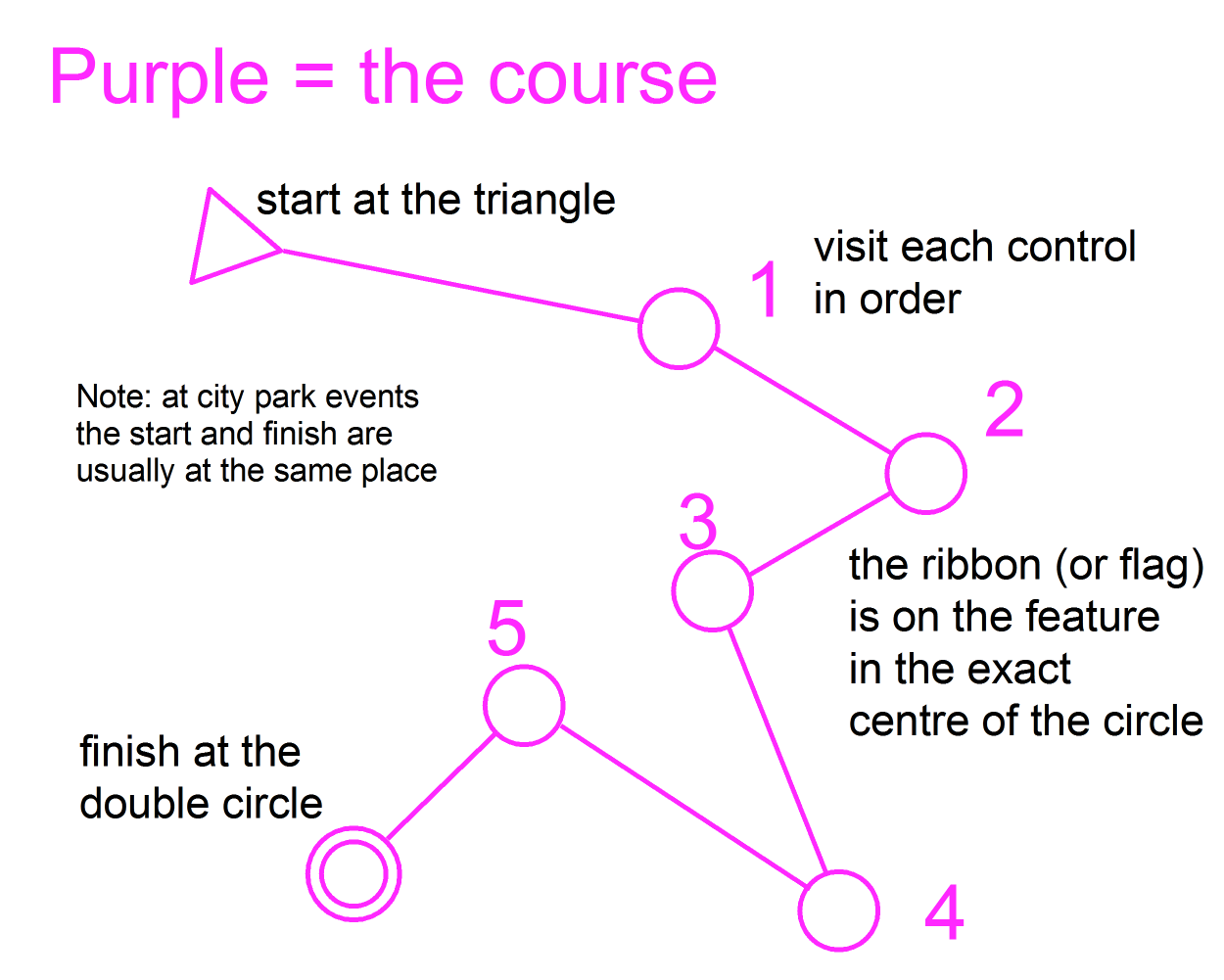
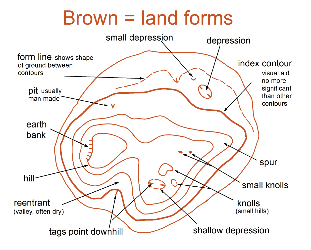
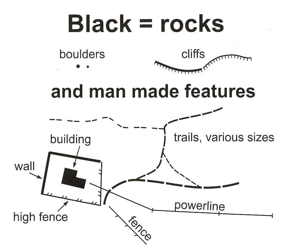
Basics of the map legend
| Yellow = open areas |  |
| White to green = forest (from easy to pass through to almost impassable) |  |
| Blue = wet features | 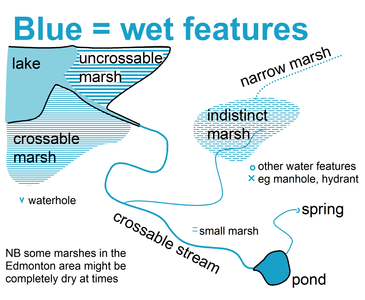 |
| Purple = the course |  |
| Brown = contour features |  |
| Black = rocks & cliffs, and man-made features |  |
Typical city park legend (a mixture of ISOM and ISSOM)
For more details go to:
International Specification for Orienteering Maps (ISOM) or
International Specification for Sprint Orienteering Maps (ISSOM) – used for orienteering maps at larger scales.