Map hints and tips
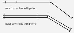
The short lines across the power linesymbol are the ACTUAL LOCATION of the power poles or pylons. |
Path junctions can be marked as DISTINCT or INDISTINCT. The left one is a distinct junction – the paths join (as do the dashes on the map). The second one shows an indistinct junction. Notice how the dashes do NOT meet. If you were traveling along the east/west path you would probably not see the other path. The second one shows an indistinct junction. Notice how the dashes do NOT meet. If you were traveling along the east/west path you would probably not see the other path. |
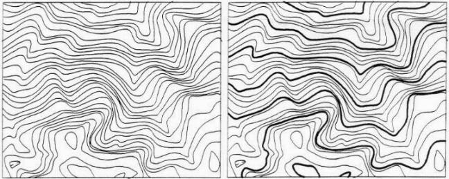
On most orienteering maps, every fifth contour is marked as an index contour with a thicker line. There is nothing special about these index contours except that they are every fifth one. As you can see from the examples below, the addition of index contours helps show the shape of the hill, plus you can estimate its height more rapidly. (I hope this hill is never on my course!). |
| The shape and size of a building is shown as its FOOTPRINT, not as its roof. For example a gas station would be shown as the size of its kiosk, not as the canopy over its pumps. Dawson and Cloverdale shelters appear quite small on city maps for this reason. A lighter shade of grey indicates a pass-through. |
| Magnetic north lines. Orienteering maps are oriented to magnetic north. The magnetic north lines should be 300m apart for forest events and 120m apart for sprint maps. |
For lots more information about map symbols, go to the International Specification for Orienteering Maps (ISOM) and International Specification for Sprint Orienteering Maps (ISSOM) websites, linked from here.


