Blackfoot Score ‘O’ 22, Sunday, May 29th
Location: Waskehegan Trailhead, Blackfoot Provincial Recreation Area
Options: Choose 1 hour, 3 hour or 6 hour time limit.
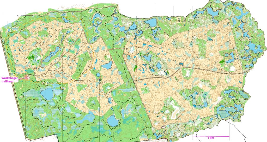
Location map
Better than average out houses next to the shelter.
Format:
22 controls with SPORTident and flags, close enough to each other for the all participants to get a good score. Many of them in the grazing fields.
Also another 38 ‘virtual’ controls which can be scored by using the MapRun6 app. These are further apart and further away from the start/finish than the real controls. There are several controls outside the fields.
For both kinds, points are won by finding controls and lost by being over the chosen time limit.
Scoring: your time starts when you punch the SPORTident start unit and finishes when you punch in at the SPORTident finish unit. The officials will calculate and deduct points if necessary of 10 points for each minute you are over time. (NO bonus for being back early).
Points for visiting the controls, whether real or virtual, are the usual standard:
50 points for any control numbered in the 50 series e.g. # 57 gets you 50 points, so does #51
80 points for any of the 80 series e.g. #88 gets you 80 points, so does #83.
and so on.
You will be able to tell from the map whether a control is real or virtual.
Real controls need to be ‘punched’ but will not get a MapRun beep. Virtual controls will beep and maybe have a ribbon, but do not have an SI unit.
You may visit the controls in any order, including changing back and forth between real and virtual. #34 virtual control will start the app for the virtual controls.
Morning registration and map hand out
10:00 – 10:55 on-site registration and map hand out for all three versions.
All participants will have up to 15 minutes to look at their map and plan* – from when they are given their map until 15 minutes later or until they punch the start control (whichever comes sooner).
Mass start for those who like them at 10:30am. OR a less stressful punch start when you are ready.
Better than average outhouses near registration.
* help available from the organizers.
Afternoon on-site registration and map hand out
12:15pm – 12:55pm on-site for 1 hour and 3 hour events. All participants will have up to 15 minutes to look at their map and plan* – from when they are given their map until 15 minutes later or until they punch the start control (whichever comes sooner).
*help available from the organizers.
Course closing: for all events, everyone must be back by 5:00pm.
What to take out with you:
-whistle (compulsory) any kind will do
– compass (loaners available)
– more water than you think you will need (none on the site) and snacks
– fully charged cell phone if you can (reasonable coverage over most of the map). Organizers’ phone # will be be printed on the back of the map.
– depending on your choice of time limit, other things that you would take on a long hike, such as a hat, sun screen, insect repellent, spare socks, small first aid kit
Entry Fees: Individuals or small Groups $20. Extra maps $5. The same fee for whichever time limit you choose. You do not need to choose which until the day! Includes SPORTident rental and loan of compass and/or whistle if you do not have your own.
Planner’s Notes: by Geraint.
I had a dilemma, should we call it “Small, Medium and Large” or “Mini – Giant Score O” or “1 hour, 3 hour and 6 hour Score O”, but then I realized I had 22 real controls and it is 2022, so went with Score ‘O’ 22.
The event used computer assisted course planning, computer assisted control hanging (or not hanging) and computer assisted scoring. My plan is to have controls arranged so that for the first hour, orienteers of all speeds will get a control every 5 minutes or less. Plus, to enhance the dopamine rush, there will be real beeping and flashing controls. After the first hour control spacing will increase. The slower orienteers will still have beepy flashy things to find, but the speedsters will have to move on to the virtual control section using Maprun 6 on their smart watch or phone.
The computer assisted part of the planning was an array of equilateral triangles of various sizes overlaid on the map and control placement on suitable features close to the nodes. The magic of Google Earth, Maprun 6, Route gadget, GPS, etc. all assist with control placement and scoring. Condes course planning software was the key helper for scoring. It has a Rogaine option for assigning points to a control based on the control number, 30 points for 31 or 33, 40 points for 45 and 80 points for control 89. It also has a feature to randomly assign control numbers across the map. I did a little manipulation of that random assignment for some of the more difficult controls outside the fields. This is to encourage competitors to use parts of the map that we have never used since it was made many years ago (all that money should not be wasted). If we have the time and the weather, we may hang ribbons at the virtual control locations, especially those in the woods outside the fields ( I suppose we should make sure they are accessible).
Fast guys should plan to finish off the real controls with number 34, because that is where the start is for the virtual portion of the course. but they can visit controls in any order (including swapping back and forth between the kinds of controls).
Rogaines typically allow planning time before the start of the race. I used the Rogaine scoring system so, to be fair to competitors l will aim to have the virtual part of the course available for download to your phone about 24 hours before the start. You can also look at your paper map for a few minutes before you start. Here is a blurry version of the map without the controls.